
The launch of Mapping History: The Calgary Atlas Project at Lougheed House is more than a conventional exhibition opening; it is a layered reimagining of how cities remember themselves. Running from April 2 to May 17, 2026, the exhibit transforms historical maps into immersive artworks, inviting visitors to explore Calgary through stories that are often overlooked or erased.
The Calgary Institute for the Humanities (CIH) founded the Calgary Atlas Project ten years ago. The idea was to create maps that recover crucial stories about Calgary’s past and present, stories that illuminate, in surprising ways, the character and diversity of the city. Overlooked stories from Calgary’s history are mapped onto the city’s geography, highlighting significant sites, events, and people. This is cartography as a cultural practice, an evolving atlas of human experience.
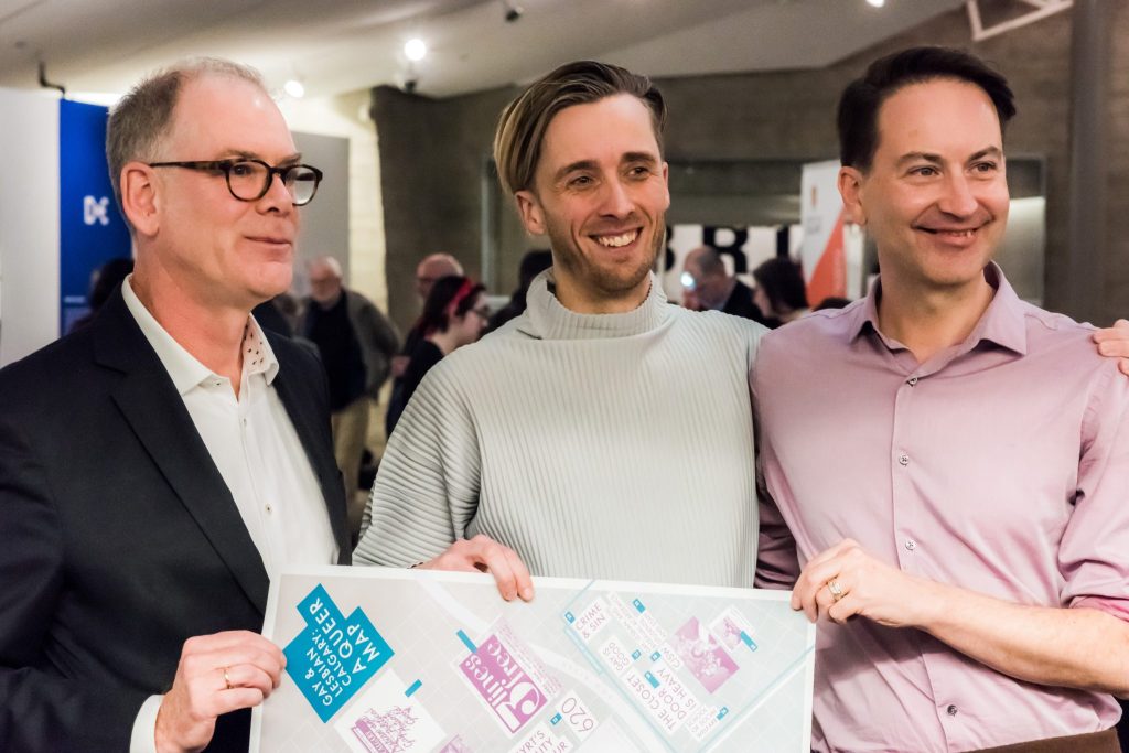
We were delighted to be involved with the Calgary Atlas Project at its inception. A Queer Map: A Guide to the LGBTQ+ History of Calgary was notably the first map produced in the series. The queer map documents community spaces, activism, and everyday life, tracing a history that has often been underrepresented in official records. By mapping sites of resistance and belonging—from nightlife venues to organizing hubs—the project demonstrates how queer communities have shaped the city in both visible and hidden ways.
The Lougheed House itself has queer history, as the site of the Fruit Loop. With that in mind, Mapping History has programmed special events such as August Klintberg’s Queer History Artist Workshop, which invites participants to engage directly with 2SLGBTQIA+ histories through creative practice, drawing on archival research and artistic interpretation.
Guided walks, like the Beltline Gay History Walk, take participants into the urban landscape itself, connecting archival knowledge to physical space. These experiences underscore a key idea: that history is not confined to museums but embedded in streets, buildings, and everyday environments.
For anyone interested in art, history, or community storytelling, this is an exhibition worth experiencing firsthand. Mapping History offers not just something to look at, but an opportunity to see Calgary differently and to understand how its stories have been shaped. Whether you attend a workshop, join a guided walk, or simply spend time with the maps themselves, the exhibition invites you to become part of the conversation.
{KA}


